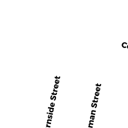
29 BURNSIDE ST
Owner Information
DESROSIERS JAMES MICHAEL
5 ALDERSGATE WAY
NORTH READING, MA 01864


Property Details
29 BURNSIDE ST is classified as a Two-Family Residential (2 family).
The primary structure on this property was built in 1925. There are 4,075ft2 of built area within this property. There is 2,362ft2 of residential/living space within this property. This property is listed as having 11 rooms.
29 BURNSIDE ST is valued at $761,200. The land is valued at $265,100 and the structures are valued at $490,900. There is an additional valuation of $5,200 on this property.
This property is in Zone GR. Confirm with local Zoning Board authorities to ensure there are no overlays or other easements on this property.
The most recent deed for 29 BURNSIDE ST is recorded at the local registrar in Book 72824, Page 137. 29 BURNSIDE ST was last sold on Tuesday, June 25, 2019 for $801,000.
Assessment data from fiscal year 2020.
Flood Data
According to the FEMA National Flood Hazard Layer, this property does not appear to be in a flood zone. It may also be in an area not yet reviewed. Nonetheless, confirm this information prior to taking any action.
To view the flood hazards around this property, create a FEMA "Firmette" Map of the area around 29 BURNSIDE ST.
Broadband Internet Providers
| Provider | Type | Bandwidth (mbps) | |
|---|---|---|---|
| VSAT Systems, LLC. | Satellite | 2 | 1 |
| HughesNet | Satellite | 25 | 3 |
| GCI Communication Corp. | Satellite | 0 | 0 |
| Starry, Inc. | Fixed Wireless | 200 | 200 |
| Comcast | Cable | 1000 | 35 |
| Verizon New England Inc. | Fiber | 940 | 880 |
| Verizon New England Inc. | DSL | 7 | 0 |
| Viasat Inc | Satellite | 100 | 3 |
Broadband service provider data from December 2020.
Adjacent Properties
- 26 CHIPMAN ST
Two-Family Residential owned by BENDOK LINDA R - 25 BURNSIDE ST
Two-Family Residential owned by PHAM ANH Q - 35 BURNSIDE ST
Single Family Residential owned by WHISPLE DAVID - 30 CHIPMAN ST
Two-Family Residential owned by FRICIA GIUSEPPE & FRANCES - 36 CHIPMAN ST
Two-Family Residential owned by CATALDO RONALD J